Contents
Index
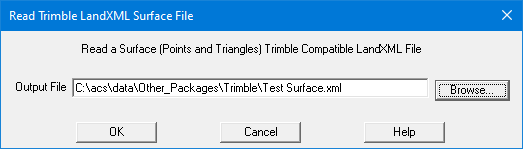
Read Trimble LandXML Surface File
This option will read a LandXML compatible with Trimble use.
It will read in the Points (CgPoints in LandXML),
the Parcels (if present)
and the Surface/triangles.
When reading the triangles surface, it will auto create the points and read the triangles (Faces in LandXML)
and add them to the surface.
Surface File Format
This is an XML file containing the Points and the Triangles.
This is a sample of some Surface file data
   <Surfaces>
      <Surface name="ABC">
         <Pnts>
            <P id="3000">7471984.889 751695.706 350.000</P>
            <P id="3001">7472000.665 751707.998 350.000</P>
    			....
         </Pnts>
         <Faces>
            F n="5 3 4">3017 5000 3016</F>
            <F n="2 0 7">3016 5000 5003</F>
    		....
         </Faces>
      </Surface>
   </Surfaces>
Explanation
- <Surfaces> - indicates the start of Surfaces section, we only have one surface in a file
- <Surface name="Road1"> - name is the name of the surface
- <Pnts> - This is the start of the points data
- <P> - The points, Id is the point number, followed by X, Y, Z values
- <Faces> - Defines start of the triangles
- <Face> - The n="5 3 4" are the three adjacent triangles, followed by the point nubers that make this triangle
- </Surface> - end of the surface data
- </Surfaces> - end of all the surface data