A linestring is a collection of lines which have a common identity
They are used in GIS systems for natural features such as water boundaries etc.
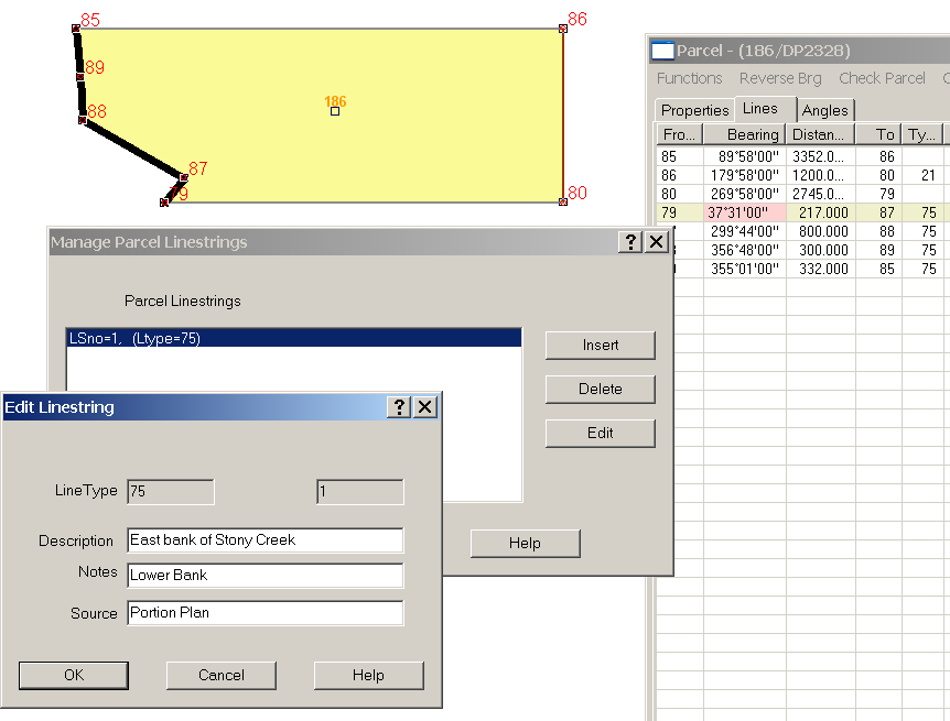
Each linestring can have a description, notes and a source
When a job is saved in LandXML format, each linestring is translated as an irregularLine.
Managing Linestrings
Linestrings are created from the lines tab in the parcels editor.
Right click on any line and select the Linestring option from the bottom of the drop down menu
A dialogue box to manage linestrings will appear and if a linestring is selected the lines will be highlighted in the parcel drawing
Each linestring in the parcel will be displayed in the dialogue box and there are options to insert, delete or edit a linestring.
Insert a Linestring
Select the insert button on the Linestring Management dialogue and the insert menu will appear.
On the insert menu, enter the line type for the linestring. Line Type
This is the line type for the lines that are to be grouped as a Linestring.
Desc
This is the description of the feature defined by the linestring.
Note
Any notes about the feature can be entered here.
Source
Any metadata describing how the feature was defined can be entered here.
Delete a Linestring
Select the linestring record in the management dialogue and hit the delete button.
Edit a Linestring
Select the linestring record in the management dialogue and hit the Edit button.
The edit menu will appear and it will allow changes to the Description, Note and source areas.